Typical Properties
Properties that typify the street scene and represent the high aesthetic
value of the buildings within this historic suburb include:
The Avenue - 13 Edwardian houses on the north side. Built by Frederick
Hill Ltd by 1911
The Broadway -14 pairs flint faced Edwardian houses on the north side,
built by 1903.
8
Lavant Road — Tudor House, designed by Osborn for himself, late 1920s,
built by Clare of Worthing. West House, also designed by Osborn and built
by Clare in 1929 for Brig Gen Lushington Osborne.
Summersdale Road — four pairs flint faced Edwardian houses on the
western side.
Highland Road — distinctive pairs semi-detached Edwardian villas on the
south side.
Brandy Hole Lane — mock Tudor house designed by Osborn for Dr Wm
Templeton, built by Clare in 1929.
Warren Farm House, Duchess style, c1880. Built for Robert Dendy
(See Photographs)
Architectural Design
Edwardian architecture features strongly within the area, with a variety of
detailing both inside and out, producing treasure houses of design and
craftsmanship well worth protecting.
Strictly speaking, the Edwardian era began when Queen Victoria died in
1901 and ended when King George V took over in 1910, but the whole
social and political scene was in process of transformation. In many
respects the Edwardian period saw the transition from the Victorian age to
our own with the expansion of towns and cities, transportation by car and
aeroplane, and when the house became a means of displaying wealth and
status. Health in the home dominated and replaced the strict moral and
spiritual emphasis of the Victorian home. House advertisements stressed
the healthy benefits of the area, with heights above sea level and low
death rates.
The notion of the Ideal Home was born in the early 20thC, with design
schemes meant to be copied in part or as a whole. Features such as
Gothic-style barge boarding to porches and gable ends, domestic revival
turrets, large tile-hung gables, vernacular pargetting and plain rough
casting, moulded bricks and terracotta flowers were common. Semi-
elliptical, segment and circular windows, leaded lights, and casement
windows with small panes all served to emphasise the builders’ eclectic
use of style.
Perhaps the most noticeable and attractive aspect of older Summersdale,
particularly along the Lavant Road and The Avenue, is the considerable
variation in roof forms. Generally two stories high, the roof/sky
relationships are important and defining. There is an informal scattered
layout of dwellings, perhaps with dormers in the roof, and chimneys that
provide vertical punctuation to the skyline.
On the northern side of The Avenue, all 13 prestigious properties built by
Frederick Hills display classic Edwardian architectural features, with many
similarities but subtle differences. Externally, several are wholly original
but others now have garages and modest extensions; some have also
been converted internally. They demonstrate the Edwardian love of
pattern and intricacy, red tiled roofs, rough cast plaster walls, and little
balconies. Flourishes of mock Tudor include patterned tiles and plaster,
with turrets, attic windows and prominent gable ends. The design and
intricacy of individual fenestration, all hand made, is a particular joy to
behold.
The houses on the south side are equally prestigious, with several built in
the 1930s before later infilling.
On both sides of the Lavant Road, are several black and white mock
Tudor-style houses, many built by A. Clare of Worthing. Built in the Arts &
Crafts style of the 1920s and 30s, with leaded lights under steep gables,
the properties reflect an evolution of Edwardian grandeur and design
concepts.
On both roads, trees and hedgerows define and articulate boundaries,
with large houses nestling in landscaped settings as if dropped into a
woodland background, giving a sense of depth to the buildings as they
recede into the landscaping. The Avenue was tree-lined from the
beginning.
Throughout Summersdale, glimpsed views abound, with clusters of
individual houses defined by the space between and around them. They
contribute to the area’s distinctive character, with an informal vernacular
architecture of flair and individuality. As with the City itself, Summersdale
has a ‘diversity in harmony’.
These characteristics and this harmony are difficult to define in planning
terms, but are immeasurably important to the street scene and very much
cherished by those who visit or live in the area — as testified by the flood
of well-reasoned letters of objection generated by any planning application
deemed inappropriate.
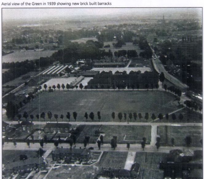
The Broadway, built on the Barracks Field immediately to the north of
the barracks in 1901-1903, featured 15 pairs of semi-detached houses or
villas, with a six foot gap between pairs. Each villa has a long back
garden, and a small one at the front. All were faced with flint and given
the name of a British Army general fighting in the Boer War at the time.
Unfortunately, only Babbington Villa now uses its original name, but most
still exist in their original frontal form, creating a distinctive row of modest
10
Edwardian properties. Most now have rear extensions, and/or the creation
of car parking to the front.
Highland Road runs parallel to The Broadway and it too was built on
Barracks Field. Development was started in 1901 with Goodwood View at
the western end and Highland Cottage at the other. Like the Broadway,
the properties were mostly semi-detached with good-sized rear gardens.
The 1912 OS map showed nine pairs of semi-detached villas and five
detached houses. These still exist and are characteristic of the Edwardian
style. They remain unchanged and well maintained in keeping with their
historic significance as a feature of Stride’s vision. Unfortunately, there is
also a row of five modern in-fill houses of a different and uncharacteristic
style that contributes nothing to the street scene other than as a stark
contrast to their Edwardian neighbours. The north side of Highland Road
was not developed until the early 1930s, and the bungalows at the
western end in the late 1950s.
Summersdale Road is the fourth element of Stride’s Summersdale
Estate, linking the eastern ends of the other three roads. Development
began in 1902 with four pairs of near-identical semi-detached houses on
the western side between The Broadway and Highland Road. The houses
have walls of flint with similar iron work for lower roof support and
decoration. All display the Edwardians’ love of craftsmanship in their brick,
stone and ironwork, and still carry their original names in alphabetical
order, Abbotsford and Brookland, Castleton and Downview, Edenvale and
Ferncliff, Glenwood and Hillside. All have been well maintained, mainly
original, and form a distinctive row of attractive properties. The pairs are
further apart than those along The Broadway, with a gap wide enough for
garages and some side extensions.
The eastern side of the Summersdale Road also has attractive Edwardian
semi-detached villas dating from c.1908. The 1912 OS map shows seven
pairs of semi-detached and one detached property (Downcote), with many
still keeping their original names. The properties on this side do not have
the distinctive flint stone facing or the ornate ironwork of those across the
road, but still form an attractive row in character with the period.
The original Summersdale Estate, the Stride vision, has survived well the
ravages of time, virtually intact with few signs of unwelcome development
along the four roads.
Development along The Drive was sporadic and dispersed. The location
of individual properties and year of development was not obvious without
extensive and documented research on each.
Summersdale Lodge, at the western end with its access to the Lavant
Road, was demolished in the early 1960s and the site re-developed as
Summersdale Court, an apartment block with its access moved to The
Drive.
11
Summersdale House, the original farmhouse, can be found at the
southern end of The Drive, together with Chestnut Cottage. Beyond
Summersdale House is Prospect House (formerly The Chestnuts), a
substantial house with natural stone walls up to first floor level, and stone
garden walls, built c.1900.
Between The Drive’s western and southern ends, Charles Stride built a
private estate in c.1905 which included a nine hole golf course designed
by James Braid, a lodge (Uplands), and a mansion (Woodland Place) with
tree-lined grounds which, as Rew Lane, was developed in the late 1950s.
The golf course was too close to the Goodwood course to be a commercial
success and it was given up for gravel extraction immediately prior to the
first World War, with a mineral branch line connected later to the
Chichester-Midhurst railway.
Summersdale Neighbourhood Character Appraisal - Typical Properties
Article Index
Page 9 of 13


