in 1876 was needed to authorise compulsory purchase of land for the track. The tender to build and manage the line from Thomas Oliver of Horsham was accepted by the Board of the London, Brighton and South Coast Railway in July 1878, and Robert Dendy was paid £1,374.10s in November 1879 for the track bed across Warren Farm.
The line eventually opened for a full three-class passenger service from Chichester to Pulborough via Midhurst on 11 July 1881. Unfortunately, the line could not compete with the motor car and the passenger service ended in 1935. A long siding of over half a mile on the downside south of Lavant Station was opened in 1913. It ran under the Lavant Road and The Drive to the newly opened gravel pits on the Stride Estate, and was still in operation in 1947. A foreshortened line serviced the Lavant sugar beet industry until 1969, and the Lavant gravel beds from 1971 to 1991 when it closed for good and the line lifted. The track bed became the Centurion Way, a tarmac path for pedestrians and cyclists.
In March 1901 the Bognor Observer reported hearsay of an application to the railway company for a station to be built at the Brandy Hole Bridge to serve Stride’s residential development in Summersdale. The railway company did not approve the proposal and no more was heard of it. The same edition also suggested a penny bus service was about to start between the Chichester railway station and Summersdale, where the development of the estate was said to be progressing well. The area was described as ‘A dry and healthy location, with gas and water laid on, and rates very low.’ Strides offered special terms by which the house became the absolute and unencumbered property of the purchaser after payment of an ordinary rental for 20 years.
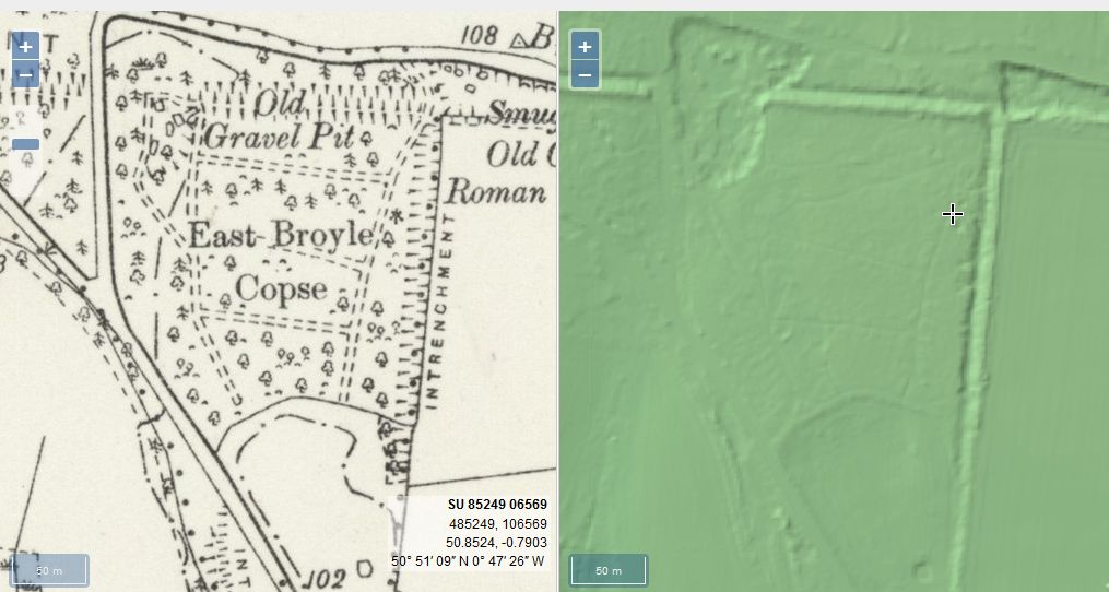
From trying to locate the areas marked on the old maps as smugglers or roman caves at the approc following locations. Our team tried to take photos as best we could.
su 85228 06608 50.8527, -0.7906 su 85255 06596 50.8526, -0.7902 su 85249 06577 50.8524, -0.7903 su 85248 06565 50.8523, -0.7903 su 85329 06661 50.8532, -0.7892 su 85359 06657 50.8531, -0.7887
The Graylingwell Heritage Project has been a community based heritage and arts programme located in Chichester, West Sussex.
The original Victorian buildings had a central boiler house with the water tower which is, after the Cathedral spire, by far the tallest building in Chichester. And if you go up to the Trundle and look down on Chichester, the only two buildings you can see are the Cathedral spire and the Graylingwell water tower.
Brandy Hole Lane, East Broyle Copse area in the northwest part of Chichester. A well-developed doline line extends east-west across the area to the north of Brandy Hole Lane, along the underlying Chalk-Reading Beds boundary.
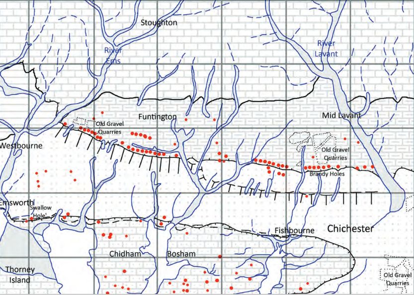
The Environment Agency has made 1m-resolution LIDAR imagery coverage for large areas of England and Wales freely available on the internet under Open Government Licence (www.lidarfinder.com).
AArc141/14/EVAL Roussillon Park, Broyle Road, Chichester, West Sussex, PO19 BBL
Sporadic finds represent the early prehistoric period in the vicinity of the Project Site, with the discovery of Palaeolithic axe in a garden on Brandy Hole Lane (c. 600m to the NW) and a Neolithic stone axe, in the vicinity of Spitalfield Lane, over 1km to the SE (Lee 2008: 9).
Bronze Age activity has been recorded c. 500m to the east of the site, in the vicinity of Garyiingwell Hospital, where evidence for settlement was identified along with remains of six cremation burials (Lee 2008: 9).
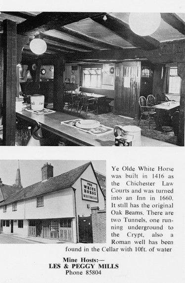
Max T I recall that there is a short length of tunnel (blocked off at both ends) under the old White Horse pub in South St. (now Prezzo restaurant, since 2005). Story in the pub was that it was part of a tunnel running from the Cathedral up to the Guildhall in Priory Park. Although the tunnel is there, I was never sure of its true purpose or the truth of its start / finish. Thought that it was worth mentioning it on here though.
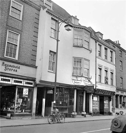
ON THE south side of East Street, close to the Market Cross, lies number 92 which up until fairly recently was The Royal Arms public house (also known as Ye Olde Punch House).
Although the façade dates to the Georgian era, the building is of a timber-framed construction said to date from the 16th century.
Much of the original building survives including highly decorated plaster ceilings displaying the Tudor Rose and fleur-de-lis.
It was once a private town house belonging to the Lumley family of Stansted.
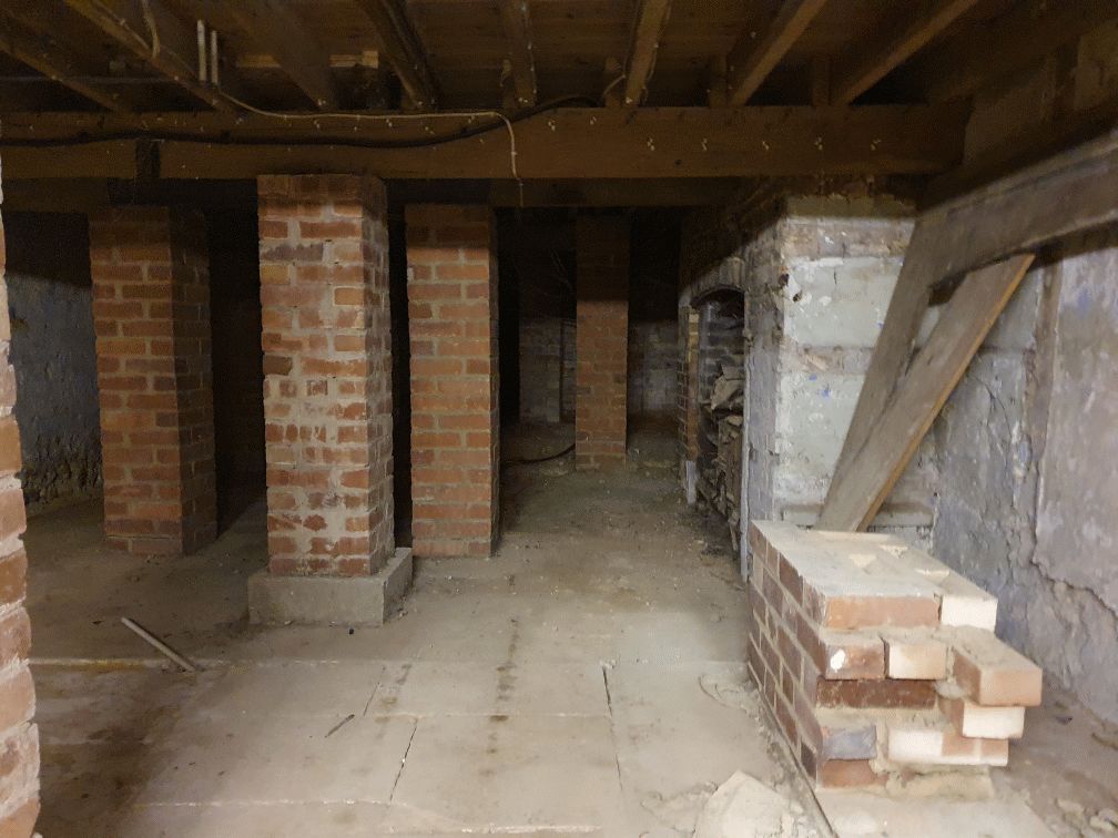
Are you curious about the tunnels in Chichester? If you are, you are not alone. Many people have wondered about the existence and purpose of these underground passages that are said to run under the city. Some claim they have seen them, others have heard stories about them, but what is the truth behind the mystery?
In this blog post, I will try to shed some light on the tunnels in Chichester, based on some web searches and historical sources. I will also share some of the rumours and legends that surround them, and invite you to share your own experiences or opinions in the comments section.


