Archaeological and Historical Background
2.1.1 An Archaeological Desk-based Assessment was produced for the site in 2014 (AMEC 2015),
and a summary of the key findings are reproduced below.
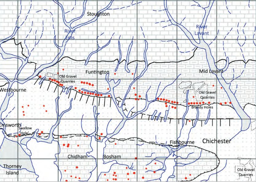
2.1.2 A small Palaeolithic handaxe was found in an evaluation 150m east of the site. There are no
records of Mesolithic finds within 500m of the site.
2.1.3 Early Neolithic pits containing pottery and flintwork were found at Baxendale Avenue some 150m
south of the site, and four small pits, one containing later Neolithic pottery, during evaluation a
Read more: Archaeological Evaluation at Lower Graylingwell, Chichester
Old Barracks / Wellington Grange

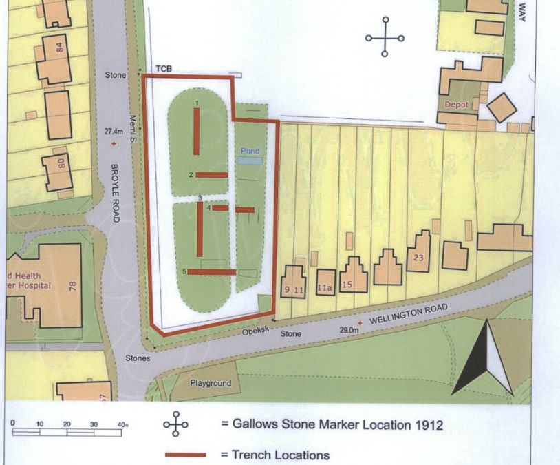
The Chichester SMR holds information for 48 sites, whilst the National Monuments Record
Centre holds details of a further 16 sites within the study area. An additional four sites were
located through analysis of historic mapping and during the course of the walkover survey and
one from aerial photographs. Full site descriptions and locations can be seen in Appendix B.
Within the report, the bracketed numbers after site descriptions relate to those allocated to
individual sites in Appendix B and on Figure 2.
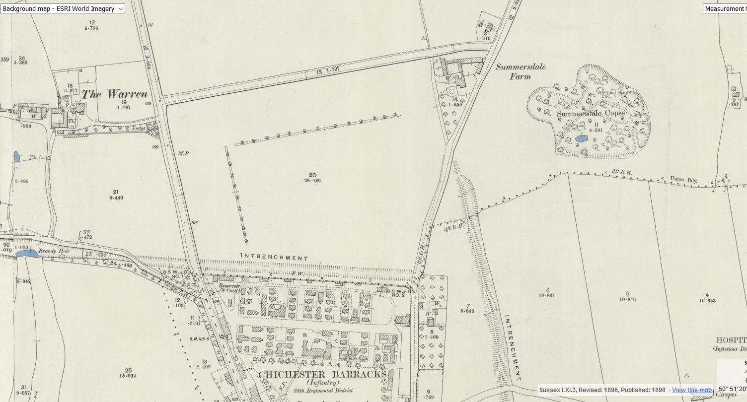
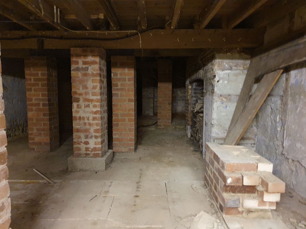
summeerdale football ,I have an update on the old newspaper article relating to Summersdale and the tunnel found under a football pitch. I sent an email to the Summersdale Residents Association, and they were extremely helpful with one of the members being able to identify a location for the site of the pitch. Looking at some old maps and combining the documents from Liam Mandville
regarding subsidence etc. the area between The Avenue and Highland Road (on the Eastern side), does fit well as to the location. Many of the properties built on this site have substantial gardens so there may still be something to find that could explain what was found by the groundkeeper all those years ago? ,5f6f8e5fb6881-116345275_10157348686446892_326855352233187857_n.jpg,5f6f8e5fb7b45-116168775_10157348685396892_1033817068655264665_n.jpg
FOOTBALL FIELD SURPRISE.
A singular happening lay behind the prosaic news on saturday that the
chuichester and District League football fixture, Summersadale VS Boxgrove, had o be postponed
owing to the ground on this hill suburb of Chichester being unfit.


