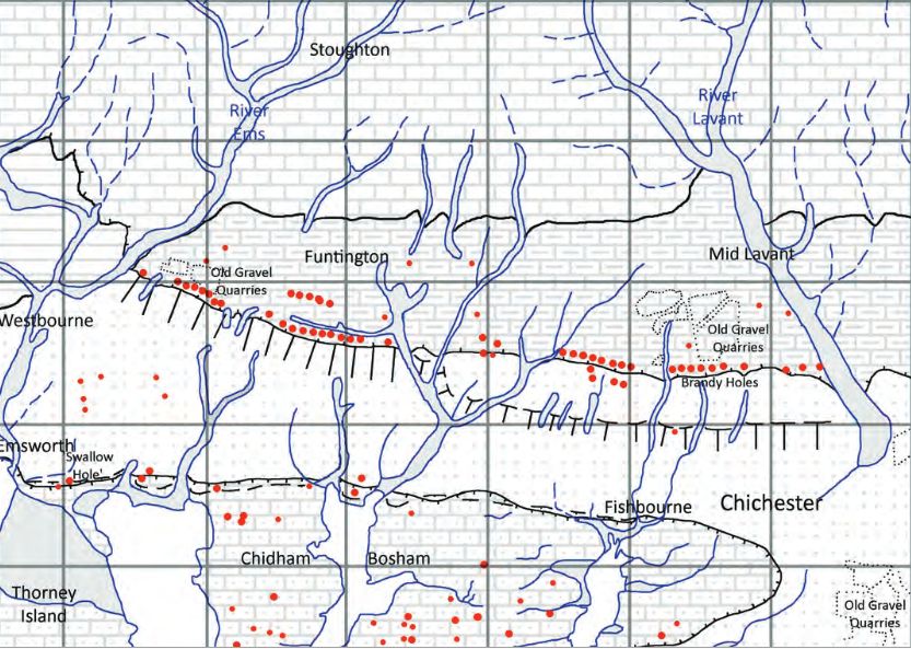
Brandy Hole Lane, East Broyle Copse area in the northwest part of Chichester. A well-developed doline line extends east-west across the area to the north of Brandy Hole Lane, along the underlying Chalk-Reading Beds boundary.
The Environment Agency has made 1m-resolution LIDAR imagery coverage for large areas of England and Wales freely available on the internet under Open Government Licence (www.lidarfinder.com).
The map (Fig. 1) shows the solid and superficial geology together with the rivers and dry valleys of the area between Emsworth and Chichester. The geology is based on BGS mapping with further interpretation by the author using the LIDAR imagery. For instance the chalk outcrop along the Portsdown Anticline in the southern part of the map is readily identified even though it is covered with a mantle of raised beach and brickearth deposits, as it shows a mottled surface on the LIDAR imagery. Dolines have been identified as shallow depressions from 5 to 15m across in the ground surface.
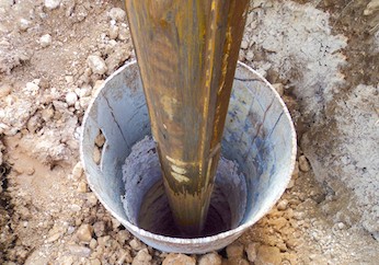
Borehole drilling is a technique that allows you to access underground water sources by creating a deep and narrow hole in the ground. In this blog post, we will explain what borehole drilling is, how it works, and what are its benefits and challenges.
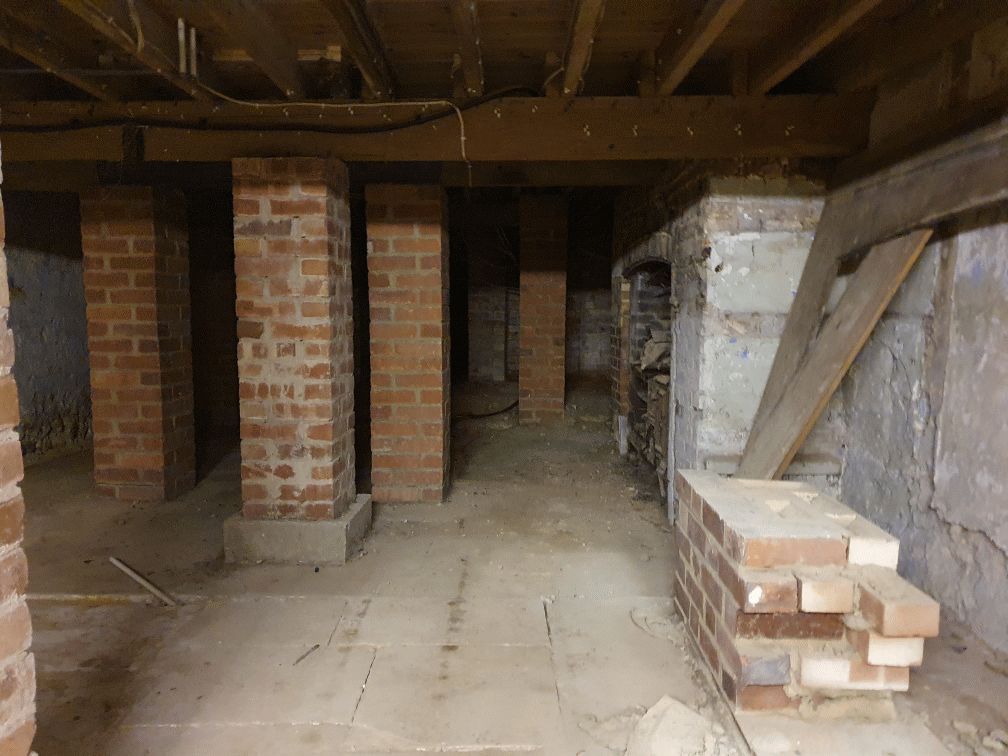
Historically, to build a house with a simple cellar you would dig out the ground to a depth of around 6ft, the cellar walls would have been constructed with a lining of stone or brick and with a drain for water within the cellar. The floors would have been built up on crushed stone or sand to provide a level surface and paved, usually with flags. Brick paving became more common in later periods.
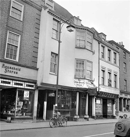
ON THE south side of East Street, close to the Market Cross, lies number 92 which up until fairly recently was The Royal Arms public house (also known as Ye Olde Punch House).
Although the façade dates to the Georgian era, the building is of a timber-framed construction said to date from the 16th century.
Much of the original building survives including highly decorated plaster ceilings displaying the Tudor Rose and fleur-de-lis.
It was once a private town house belonging to the Lumley family of Stansted.
There is rumoured to be a tunnel from the white horse to the buttery and then from the buttery to the cathedral.
Regarding a tunnel from the crypt to the cathedral. Apparently Keats while upstairs being "entertained" watched the monks lock the gate to the cathedral. Now did he have xray specs on ??? That''s the pic of the guy gesturing towards the shelves is where the door way used to be
researching properties using the council planning system
An introduction to researching properties
where are the tunnels?
Are you curious about the tunnels in Chichester? If you are, you are not alone. Many people have wondered about the existence and purpose of these underground passages that are said to run under the city. Some claim they have seen them, others have heard stories about them, but what is the truth behind the mystery?
In this blog post, I will try to shed some light on the tunnels in Chichester, based on some web searches and historical sources. I will also share some of the rumours and legends that surround them, and invite you to share your own experiences or opinions in the comments section.
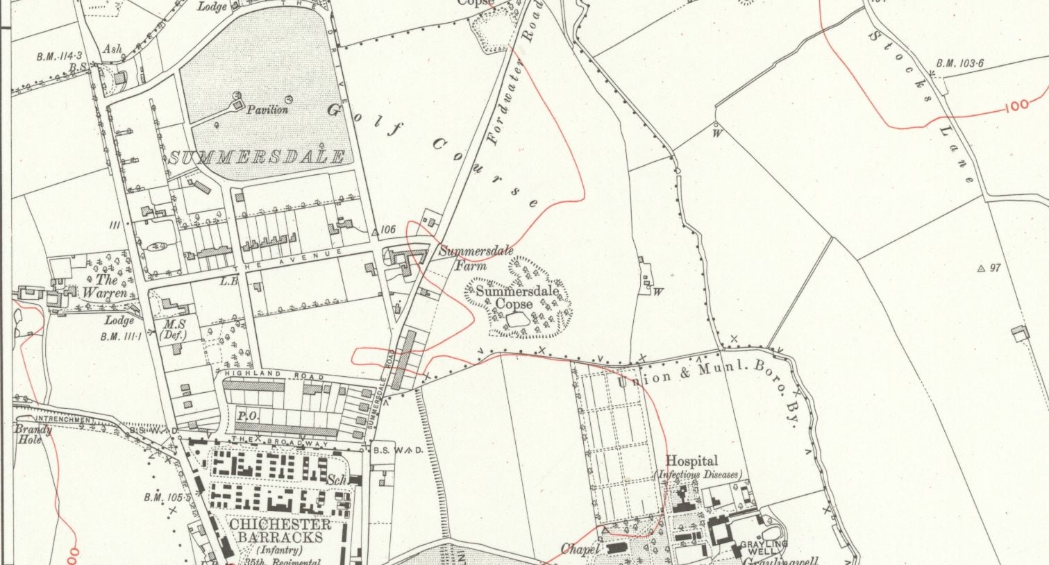
summeerdale football ,I have an update on the old newspaper article relating to Summersdale and the tunnel found under a football pitch. I sent an email to the Summersdale Residents Association, and they were extremely helpful with one of the members being able to identify a location for the site of the pitch. Looking at some old maps and combining the documents from Liam Mandville regarding subsidence etc. the area between The Avenue and Highland Road (on the Eastern side), does fit well as to the location. Many of the properties built on this site have substantial gardens so there may still be something to find that could explain what was found by the groundkeeper all those years ago? ,5f6f8e5fb6881-116345275_10157348686446892_326855352233187857_n.jpg,5f6f8e5fb7b45-116168775_10157348685396892_1033817068655264665_n.jpg
A number of those readers remembered a story about tunnels underneath Hansford Menswear, also in South Street, so we spoke the shop's owner to find out more Matthew Hansford described a blocked-off passage in cellar of the shop, which he believes may have led to the cathedral


